

Location: Mohave County, Arizona
Size: 40 claims, 800 acres
Type: Lode
The Rawhide project consists of two claim groups: The Silver Mountain group consisting of 34 claims and the Little Kimble group consisting of 6 claims. The total claim package is 40 claims covering 800 acres.
Exploration Potential:
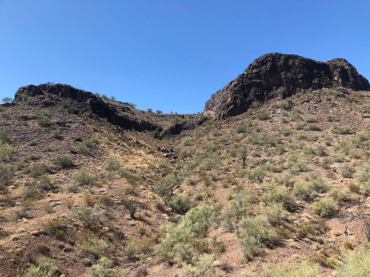
The Rawhide and Buckskin Mountains are a well-known detachment fault district hosting polymetallic shear zone and replacement deposits.
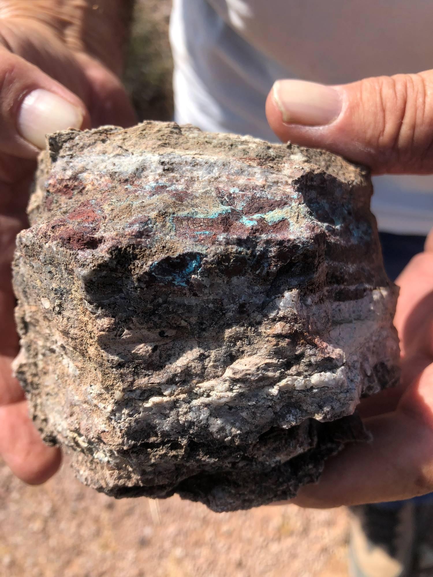
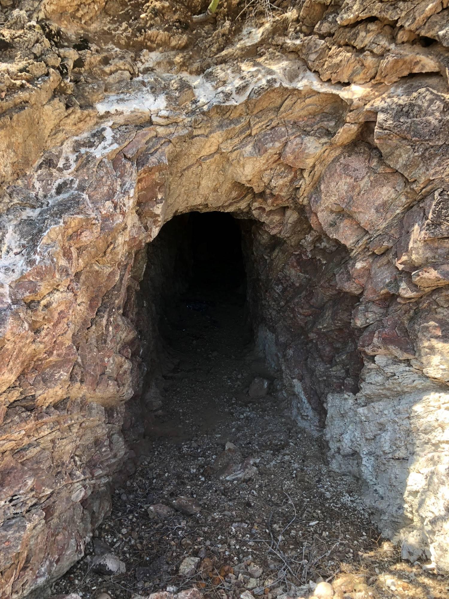
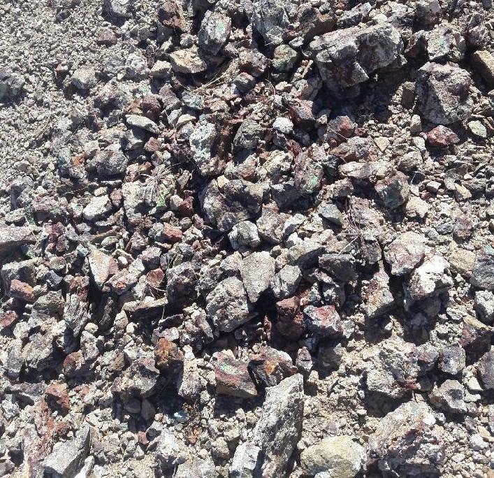
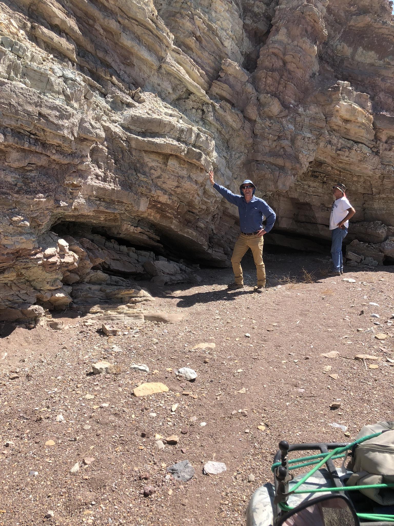
The area of our claims has numerous high-grade outcroppings with spectacular, highly mineralized copper oxide mineralization, sulphides, and gold mineralization. Some of these outcroppings are in historical mine complexes and others are unmapped (see images above).
Most of the historical mining was focused on these high-grade outcroppings which could be hand sorted. The historical production was quite small, but does not accurately reflect the modern potential for bulk tonnage deposits.
The discovery and continued development of the Copperstone Mine (owned by Kerr Mines) which has produced 500,000 ounces and has a current measured and indicated resource of 276,000 ounces is a good example of the potential for detachment related deposits.
The USGS reviewed the district in Open File Report 93-0228, “Grade-Tonnage Data for Polymetallic Detachment Faults” and came to the following conclusion:
“Past production centered on the higher grade portions of the deposits which could be easily hand-sorted or otherwise concentrated into a salable product. Only a few of the deposits have been explored by modern methods in order to delineate large, low-grade ores amenable to heap-leaching operations. The Moon Mountains district, whose reported production amounted to some 300 st of high-grade ore, has proven to host some 7 million st of ore minable by modern methods. The 50 million st Copper Basin deposit indicates that fairly substantial deposits are possible. Given the vagaries of these data, construction of a grade-tonnage model is not justified.”
We believe the Rawhide and Buckskin Mountains detachment fault area has the potential for the development of several multi-million ounce gold equivalent deposits. A combination of modern methods including advanced geochemistry and geophysical surveys could successfully locate these deposits.
Our Properties:
Our two properties in the Rawhide District are the Silver Mountain and the Little Kimble.
The Silver Mountain claim group includes the Betsy Ross historical mine and the Goat prospect. The Betsy Ross has two small adits with high grade polymetallic ore. The high-grade outcrop at the Betsy Ross is surrounded by thin alluvial cover.
The Goat Prospect is a series of shear zones and veins outcropping in the NW part of the claim group. Grab samples on a previously unidentified vein assayed 15% copper, 2 ppm gold, and 32 ppm silver. Another nearby sample assayed at 3% copper, 26 ppm gold, and 1.9 ppm silver.
Our soil sampling program discovered two copper-gold anomaly areas in the Goat area. Only limited sampling was done. Previously sampling programs in nearby districts have been successful in locating mineralized detachment fault deposits under alluvial cover.
The Little Kimble prospects are near the Kimble historical mine complex which had recorded production of 4,400 tons grading 0.34% copper, 0.12 opt gold and .028 opt silver (Bulletin 198, Arizona Geological Survey).
The Little Kimble claim group includes six (6) mining shafts, two adits, and numerous prospect pits. The Little Kimble group is classified as a lower plate, fracture filling deposit that is striking NW-SE. The spread of shafts and prospect pits confirm this. The strike length of this deposit is approximately 1 mile long with a sub-parallel deposit 1,500 feet SW that has a strike length of one-half mile long. There may be another sub-parallel deposit 1,500 feet NE that outcrops sporadically under alluvial cover.
The long strike length, good grades, nearby structures and potential for discoveries under alluvial cover make this a strong prospect.
Regional Geology:
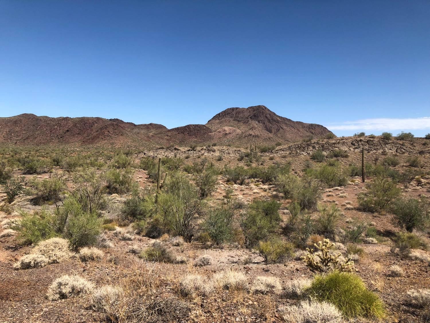
The geology in western Arizona is dominated by extensive detachment faults related to metamorphic core complexes. The Rawhide and Buckskin Mountains are the most famous of these, but additional such detachment fault areas are found throughout Western Arizona.
Metamorphic core complexes are uplifted bodies of deep crustal metamorphic rocks due to regional extension. Associated with these metamorphic core complexes are sub-horizontal faults called detachment faults. Detachment faults have large displacements (hundreds of miles) and the upper plate and lower plate rocks are often not related.
The detachment fault itself is either flat lying or gently dipping, however, there are often steeply dipping shear zones connected to the detachment fault which can serve as host structures for various ore bodies.
The detachment fault itself is often mineralized and hosts ore bodies within 10 meters up to 100 meters of the fault plane.
Copper is the primary mineable commodity, but gold, silver, lead and zinc are also found.
The definitive report on this area is the Arizona Geological Survey’s Bulletin 198, “The Geology and Mineral Resources of the Buckskin and Rawhide Mountains” by Jon Spencer and Stephen Reynolds. This report covers all the historical mines with extensive geological mapping and observations of the entire area.
Location and Access: The claims are located 27 miles southwest of Wikieup, Arizona. Wikieup is 80 miles south of Kingman, Arizona. From Wikieup, head west out of town on Chicken Springs Road (RR 131) and continue for 14.6 miles. At the intersection, head south on Alamo Road (RR 15) for 11.4 miles. Jeep trails meet up with the road at several washes and continue to all the claims in the area.